Utah stays quiet. It does not need to fill the space. The ground itself explains the scale - long rock corridors, dry canyons, high passes where snow lingers past April into early May.
Anyone browsing for ways to spend time in the state usually starts with how much room there is - for walking, for driving, or for doing nothing at all.
People arrive for plain reasons. A line of pavement. A jagged ridge. A chance to leave behind whatever took over the last stretch of their year.
Whether the plan covers five hours or seven days, most find the state gives back more than what was on the list.
The State Itself - Utah's Practical Edge
Utah covers a range in every sense - season, terrain, and public access. Around 70 percent of the state falls under public ownership, much of it open without restriction.
Inside the borders are five national parks, eight national monuments, and a web of state trails, reservoirs, and open routes.
The main draw is visibility. Most of the places worth seeing are not locked behind barriers. What matters more is when you arrive.
In January, the Wasatch Range leads. Alta and Snowbird sit about 40 minutes from Salt Lake City and carry most of the winter traffic for skiers.
By June, the shift moves south. Moab takes on a different pace, used mainly as a launch point for riding or hiking.
The gaps between high season hold their own. Spring and fall draw fewer visitors, with cooler days and clearer air.
Anyone trying to plan around Utah's options won't need fixed categories. The state moves more by pace than by type.
Structured days or open time both work. You don't need to settle on the shape of the trip until you're already in it.
10 best places to visit in Utah for your next vacation
- Zion National Park
- Arches National Park
- Bryce Canyon National Park
- Lagoon Amusement Park
- Temple Square
- Loveland Living Planet Aquarium
- Thanksgiving Point
- Brighton Resort
- Canyonlands National Park
- Dixie National Forest
| Activity / Destination | Type | Location | Best Season | Access Needed | Geographic Factor |
|---|---|---|---|---|---|
| Arches National Park | Hiking / Geology | Near Moab | Spring, Fall | Park entrance + trail access | Entrada Sandstone, desert plateau |
| Zion National Park | Hiking / Scenic | Southwestern Utah | Spring, Fall | Shuttle + permits (some) | Narrow canyon, Navajo Sandstone cliffs |
| Bryce Canyon | Hiking / Geology | South-central Utah | Late Spring-Fall | Park entrance + trails | Amphitheaters, high elevation, freeze-thaw |
| Great Salt Lake | Viewing / Nature | Near Salt Lake City | Spring-Fall | Causeway to Antelope Island | Hypersaline lake, variable shoreline |
| Snowbasin Ski Resort | Skiing | Near Ogden | Dec-April | Road + lift ticket | Alpine slopes, high snowfall |
| Alta Ski Area | Skiing | Little Cottonwood Canyon | Dec-Late April | Road + lift ticket | Steep terrain, high base elevation |
| Bonneville Salt Flats | Viewing / Driving | West Utah (near Wendover) | Summer, Fall | Pull-off on I-80 | Flat salt crust, lakebed remnant |
| Moab Bike Trails | Biking | Eastern Utah | Spring, Fall | Road + trail access | Slickrock terrain, desert plateau |
| Capitol Reef Access (Torrey) | Hiking / Scenic | Central Utah | Spring-Fall | Highway 24 + local roads | Folded rock, remote valleys |
| Bears Ears Access | Hiking / Remote | Southeastern Utah | Spring, Fall | 4WD roads + maps/GPS | Rugged mesas, limited infrastructure |
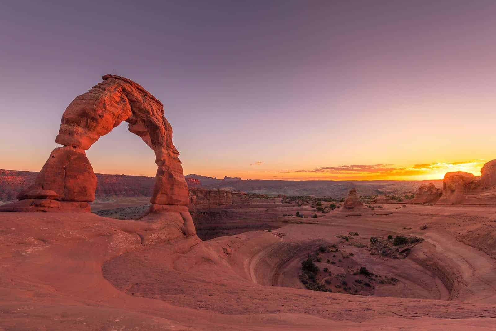
Arches National Park - Small Scale, Tight Design
Arches National Park spans a little over 76,000 acres, which places it on the smaller end of western national parks.
The boundary sits five miles north of Moab. Federal protection began in 1929 when it was marked as a national monument. Congress reclassified it as a park in 1971.
Its main statistic is the density of arches: the National Park Service lists more than 2,000. That count shifts over time as erosion continues to cut and collapse new forms.
Most of the shapes come from Entrada Sandstone. It breaks apart through cycles of freezing and thawing, and from deeper underground, the slow adjustment of salt beds.
Nothing about the process moves quickly. But those two actions - surface cracking and subsurface distortion - account for the area's spires, arches, fins, and domes.
Delicate Arch, used often in tourism photos, sits at the end of a 1.5-mile hike. The trail has no tree cover. That keeps traffic from bunching, especially midday.
Temperatures in July and August reach over 100°F with low wind. Spring and fall see cooler days.
Fiery Furnace runs like a hallway of canyons. Access requires a ranger-led tour or a pre-approved permit. Safety is part of the reason, but so is conservation.
The park limits what you can see from a car. It was laid out for walking. Most of what matters sits behind the first turn, at close range, where the shapes feel scaled to you.
Zion National Park - Tight Paths, High Walls
Zion became a national park in 1919, the first in Utah to receive that designation.
Its main feature is Zion Canyon, shaped by the North Fork of the Virgin River. The canyon stretches close to 15 miles.
The cliffs, made of Navajo Sandstone, rise to 2,000 feet from the floor. That vertical rise narrows both movement and schedule.
By early April, shuttle buses run every day. Private vehicles are blocked from the main canyon once that system begins - a restriction in place since 2000.
Angel's Landing, a trail known for its ridge section near the top, shifted to a permit system in April 2022. The permit was added after high traffic caused stability concerns on the route.
Other trails shift with the weather. The Narrows follows the riverbed through a slot canyon and closes often in spring due to runoff or flood alerts.
Water stays near 40°F in early spring. Summer raises different concerns - overheating, flash storms, and limited cover.
Zion does not build to its scale. The rock walls start rising at the entrance. Walking the canyon means moving through a space that climbs straight up on both sides.
Bryce Canyon - Freeze, Thaw, Repeat
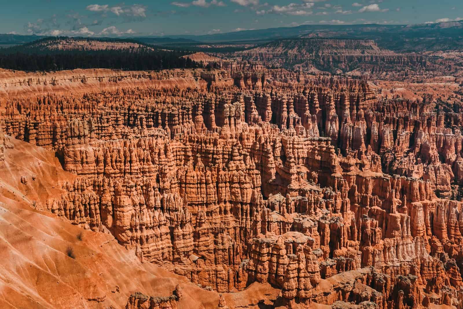
Bryce Canyon stands at an elevation of 8,000 feet. That height shifts the seasons, extends snowfall, and drives a slower kind of erosion.
The name misleads. It's not a canyon but a series of amphitheaters etched by meltwater and the steady grind of freeze-thaw cycles.
Hoodoos rise where water seeps into cracks, freezes overnight, and forces pieces of rock to fall. Over time, those breaks stack into spires.
Snow comes early and stays long. Yearly totals average more than 90 inches.
Summer brings sharp storms. Between the two, the landscape keeps changing shape slowly, but without pause.
Sunlight redraws the color. From the rim at Sunrise and Sunset Points, trails wind down into narrow gaps that shift with the angle of the light.
Bryce became a national monument in 1923 and a national park in 1928.
The high elevation holds spring back, shortens the warm season, and keeps nights cooler than parks in the lower desert.
Dry air and minimal light pollution support regular night programs through the fall.
Most routes drop in and climb out. There's little ground that stays level.
That's part of the draw. From above, the rock seems fixed. Once you're in it, the only way forward is down and back up again.
Great Salt Lake and Antelope Island - Geography Sets the Terms
The surface of the Great Salt Lake keeps dropping. In October 2022, the U.S. Geological Survey measured its lowest reach on record, more than 60 percent smaller than its 1980s footprint.
Salt concentration shifts with runoff and depth. In some stretches, the mix nears 30 percent.
Antelope Island connects to the mainland by a seven-mile causeway. After years of heavy rain, it remains surrounded. During dry spells, the shoreline peels back and leaves wide flats of salt and mud.
Water levels reset what moves. Brine shrimp feed the lake's web and supply a narrow trade in aquaculture stock.
The smell doesn't hold still either. As heat rises, sulfur from decaying matter mixes with the brine and sharpens the air, strongest near the edge.
The lake alters the snow, too. Storms that pass over it gather moisture, then drop heavier snow along the Wasatch Front.
For anyone staying near Salt Lake City, Antelope Island shows how the ground shapes the pace.
What you can walk, ride, or watch depends on wind, runoff, and what the lake decides to give back.
Snowbasin and Alta - Altitude Without Congestion
Alta began operations in 1939, making it one of the oldest ski areas in the country. Snowbasin followed in the 1940s and later hosted downhill events during the 2002 Winter Olympics.
Both sit within an hour's drive of Salt Lake City - neither functions like the large, walk-in resort towns farther east.
Parking remains limited. Lodging and retail space are minimal. Alta starts at over 8,500 feet, which helps keep snow coverage longer into spring.
Snowboarding has never been allowed at Alta. The rule narrows the visitor base and reduces mixed-use traffic on the slopes.
Terrain at Alta leans steep, with several double-black zones accessible by lift.
Snowbasin stretches elevation more gradually. The layout includes long, open routes, which is part of why Olympic planners selected it for speed events in 2002.
Each mountain receives over 500 inches of snow on average per year.
In late April 2025, runs above 9,000 feet remain skiable.
While high-volume resorts like Park City handle the bulk of tourism, Snowbasin and Alta serve a different pattern: people who drive up, ski without long waits, then head back down the same day.
Neither site builds for foot traffic. They function around the hill, not the base. That setup draws a portion of skiers looking for slope access over village features.
Bonneville Salt Flats - Where Racing Meets Silence
The Bonneville Salt Flats sit west of the Great Salt Lake Basin, near the Nevada line. They stretch close to 30,000 acres - white, flat, and almost bare.
Long ago, this space was under Lake Bonneville, a prehistoric lake that covered much of western Utah. When the water vanished, salt stayed behind.
Now it's a sheet of sodium chloride. Dry when the weather holds, smooth enough to read light off the surface.
Racers started using it in the 1930s. The flats didn't need clearing or grading. The scale was already in place.
Straight-line runs still happen here, but only when the surface dries hard. A single storm can shut it down. In dry years, vehicles go past 300 mph.
Interstate 80 runs just south. There's a pull-off where people step out and walk onto the crust.
Beyond that, no buildings, no barriers. No services. It's open ground.
Film crews come for the blank frame. Engineers bring prototypes. Others walk until the horizon holds no lines.
Wind resets the surface each night. The silence is not figurative - it's the result of nothing nearby to interrupt it. No trees. No change in elevation. No break from the sky.
Small-Town Access Points - Off the Grid but on the Route
Kanab sits along U.S. 89, close to the Arizona line. It falls inside a two-hour radius of Zion, Bryce, and Grand Staircase-Escalante.
Fewer than 5,000 people live there full-time. Traffic climbs sharply from March through October.
Lodging fills fast. Prices for fuel and groceries shift with the tourist calendar.
Moab anchors two national parks - Arches and Canyonlands - and began its shift into tourism in the 1980s, tied in part to the spread of mountain biking.
The Slickrock Bike Trail opened in 1969. Since then, April and May have stayed among its busiest periods.
Off-road events and guided Jeep tours stretch demand through spring and fall.
Torrey handles traffic to Capitol Reef. The town follows one main route and has fewer than ten year-round restaurants.
April still brings freezing nights, but by mid-month, trail use picks up.
Blanding and Bluff sit farther south, near the western edges of Bears Ears National Monument.
From there, infrastructure thins. Paved roads, cell signals, and signage drop out past town limits.
Many trailheads begin in dirt lots, marked by GPS points or local maps rather than formal signs.
The towns themselves are not the goal. They support the start - places to refuel, pause, or plan again.
They mark where the pavement ends and the slow work of travel begins.
FAQ: Things to Do in Utah
What town in Utah is best for non-Mormons?
Park City usually ranks near the top of that list. It has an international crowd, many seasonal visitors, and fewer ties to church-centered life. Plus, with film, food, and skiing all packed into one small mountain town, it stays lively.
Why is Utah famous for?
The five national parks get most of the headlines, but it's more than that. Utah's known for its big desert views and deep snow in the Wasatch, and it is the headquarters of the Church of Jesus Christ of Latter-day Saints.
What not to miss in Salt Lake City?
Start with Temple Square and the State Capitol. Then go west for the Great Salt Lake, or head into the foothills. If the timing's right, the Utah Arts Festival or a Real Salt Lake match adds something local to the trip.
Can you swim in the Great Salt Lake?
You can, and many do, especially near Antelope Island. The salt makes you float higher than you'd expect. But wind, insects, and lake levels can change things fast, so check conditions first.
What is the most popular thing in Utah?
Zion National Park is hands down the best. According to the National Park Service, in 2022, it had more than 4.6 million visits, the highest of any site in the state.
What percentage of Utah is Mormon?
According to 2022 figures from the Church and census sources, about 42% of Utahns are members. That number used to be higher, but it's been shifting over the past couple of decades.
Why do tourists come to Utah?
Some come for red rock hikes, others for the snow. Many want to see the parks - Zion, Arches, Bryce Canyon - or ski the Wasatch. A few show up for festivals, music, or to see where it all started for the LDS Church. There's space for all of it.
🌄 Utah Trip Planning Resources
Here's a list of trusted websites to help you plan things to do in Utah. Each link below covers a different aspect of travel - from state parks and scenic roads to local events and transit info.
🏞️ Official Travel & Tourism
- Utah Office of Tourism
Trip ideas, itineraries, and seasonal planning tools. - Utah.com
Info on national parks, outdoor activities, and travel services. - Visit Salt Lake
Local events, attractions, and travel logistics in Salt Lake City.
🏕️ Parks & Outdoor Recreation
- National Parks in Utah (NPS)
Official pages for Zion, Bryce, Arches, Capitol Reef, and Canyonlands. - Utah State Parks
Park guides, updates, and recreational options. - Reserve Utah State Parks
Online reservations for campsites and day-use areas.
🚗 Road & Travel Conditions
- UDOT Traffic
Live updates on traffic, road work, and closures. - Utah Road Conditions & Safety
Weather advisories, driving tips, and seasonal road guidance.
🏔️ National Parks & Monuments
- Zion National Park
Maps, trail conditions, and shuttle info. - Capitol Reef National Park
Visitor guides, scenic drives, and geology highlights. - The Mighty 5
Explore all five national parks in one guide.
🏙️ City & Regional Guides
- Salt Lake City Travel Guide
Local attractions, neighborhoods, and itineraries. - SLC Travel Info
Maps, brochures, and visitor services for Salt Lake City.
🚌 Transit & Getting Around
- Utah Transit Authority (UTA)
Light rail, bus routes, fares, and service alerts.
🍀

