Lakefront Property Built by Wind - Natural Infrastructure at Work
The dunes don't sit still. They weren't meant to. Every gust off Lake Michigan deposits another layer, pulls another grain free, and carves the shoreline like it's still in motion - which it is.
Indiana Dunes State Park, officially established in 1925 in Porter County, Indiana, rises and recedes in slow rhythms, shaped by centuries of wind, water, and glacial retreat.
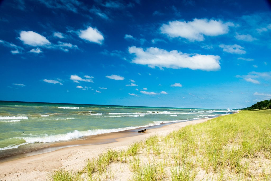
The beach isn't just a beach. It's the aftereffect of ice age melt - when Lake Michigan's level dropped, new dunes formed along the exposed lakeshore.
What looks like an endless ridge of sand is a series of timelines. Younger dunes form near the waterline, where the wind drops fresh sand.
Older ones - some now forested - lie inland, buried under black oak, cottonwood, and juniper.
At 1,530 acres, the Dunes Nature Preserve stretches across the eastern side of the park.
It's all foot access here - no vehicles, no shortcuts. That's where blowouts happen. They aren't blasts, though they leave a crater.
When roots let go - because of a fallen tree, a footpath, or an animal trail - wind takes over.
Sand moves fast, and before long, you're staring at exposed stumps in a place like Big Blowout.
Locals call it the Tree Graveyard.
Each of the park's blowouts - Beach House, Furnessville, Big Blowout - tells the same story in different chapters.
They push into interdunal troughs, revealing layers most places never show. And they keep growing.
Visitors from Chicago, Michigan City and beyond walk the shoreline without realizing they're in motion, too.
Even paved paths shift under the pressure of sandbanks and lake tides. For people looking up "things to do east of Chicago," this place ranks high. It always has.
And while newer trails and observation decks are mapped and maintained, the dunes don't read maps.
They grow, collapse, and start again. Natural infrastructure - open year-round.
Land Use, Deals, and Deadlines - A Property History in Pieces
The deal was made official in 1925. Indiana Dunes State Park opened under the banner of the Indiana Department of Conservation years before it became the Department of Natural Resources.
But the groundwork had started earlier - Richard Lieber had scouted this stretch of land when shaping Indiana's state park system.
Over the decades, land swaps and boundary lines shifted.
The state park ended up surrounded by Indiana Dunes National Park, which gained its own national designation in 1966 and was redesignated as a full national park by an act of Congress in 2019.
Inside that perimeter, jurisdiction gets complicated. The National Park Service owns the water offshore - 300 feet from the high water mark.
But everything inland, including the dunes, beach, and preserve, remains under state control.
Preservation efforts didn't always move smoothly. Local advocates like Save the Dunes Council pressured state and federal agencies through the mid-20th century.
Zoning battles reached the courts. In 1974, the park was designated a National Natural Landmark, a move that boosted its visibility without changing its ownership.
By 2018-2019, Indiana Dunes State Park led all state parks in Indiana for annual visits.
Over 1.3 million people came that year alone. And it wasn't just summer tourists - real estate agents, campground managers, and local businesses in Porter and Chesterton saw the impact in year-round foot traffic.
The Indiana State Budget Agency reported steady funding allocations for park upkeep and trail maintenance tied to those numbers.
All the while, the dunes kept changing shape - proof that natural boundaries didn't always care about legal ones.
Trail Inventory - Access, Elevation, and Foot Traffic
There's a rhythm to the trails here - some loop short and quick, others stretch through the preserve for hours.
Indiana Dunes State Park offers 16 miles of hiking routes. But the layout isn't symmetrical. That's the point.
Trail 10 runs longest - 5.5 miles end to end. It starts near the pavilion, right by the old bathhouse. From there, it hugs the shoreline, heading east before veering inland at the Beach House Blowout.
It's a moderate walk, but the variety makes it feel longer: open beach, wooded marsh, rolling sand hills.
Halfway through, it hits the eastern boundary near Paradise Valley, where you pass the Pinery and cross a branch of Dunes Creek.
Toward the end, the trail moves past the marsh and the bird observation tower before finishing up at the Nature Center.
Trail 8 packs more elevation into less distance. It climbs all three of the park's named dunes - Mt. Tom (192 ft), Mt.
Holden (184 ft), and Mt. Jackson (176 ft). The full trail is just 1.5 miles, but the incline earns it a rugged label.
Hikers step through sand one minute and forest shade the next.
The Calumet Trail, meanwhile, crosses the park's northern boundary and links up with the national park.
It's one of the few spots where bikes are welcome - most other trails restrict wheels.
Still, people show up on foot every season, even in winter, when the trails freeze, and the shoreline takes on ice shelves.
There's no single loop that covers it all. The trail system moves like the land itself - angled, layered, and built for the long walk instead of the shortcut.
Seasonal Inventory - Shore Access, Rentals, and Recreation Rights
Summer shows up in small signs - concession windows sliding open, lifeguard chairs returning to the swim zone, dogs leashed and zigzagging toward the dunes.
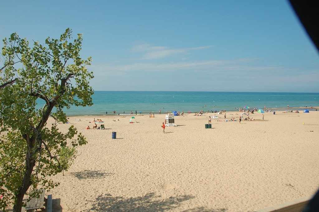
Indiana Dunes State Park divides its 3-mile shoreline into two categories: one guarded, the other open.
The public swimming beach operates between Memorial Day and Labor Day. Everything else - roughly two miles of sand - is fair game for sunbathing, fishing, or pacing out a morning walk.
The beach house, a mainstay since its original construction, still runs summer concessions. It's less a hub than a pulse point.
Rental businesses operate close to the park boundary in Porter, offering kayaks and paddleboards, though the state-run section maintains tight control over commercial activity on its sands.
You won't find jet skis or parasailing here.
Fishing is legal but seasonal. Smelt runs peak in early spring, and anglers come prepared - coolers, nets, and permits in order.
Indiana Department of Natural Resources regulates the take, and enforcement officers patrol the beach during high-traffic weekends.
Smelt isn't a commercial catch here, but their local following stays loyal.
Then there's the haunted stuff. Ask around, and someone will mention Diana of the Dunes. It's tied to Alice Gray, a University of Chicago student who lived in the dunes in the early 1900s.
Her ghost, by some accounts, still walks the shoreline. The story gets retold often, especially during the Dunes Halloween Hike - a park event that blends local folklore with actual trail time.
For birders, the marsh off Trail 10 is the place to be. Spring migration brings warblers, hawks, and waterfowl - over 350 species have been logged in the broader dunes region.
A tower overlooks the area, and binocular sales see a bump every April in local Porter and Chesterton shops.
Built Assets - Campground Features, Utility Access, and Structural Footprint
Construction finished in 2004, but the campground still feels new. Asphalt loops, full-shade sites, dual shower houses - everything laid out with both RV and tent setups in mind.
There are 140 campsites, each with 50-amp electrical hookups, picnic tables, and water hydrants spaced across the grounds.
The roads, also paved that year, create easy turnarounds for large vehicles.
Reservations go fast during peak months. Indiana DNR uses the ReserveAmerica system to manage bookings, and weekends fill up before spring is halfway through.
Some sites are close to the forest, and others are closer to the short trail leading to the beach.
The Nature Center operates year-round. It has a library, an auditorium, and a wildlife observation window where visitors can watch birds hit feeders or scan the marsh.
Guided hikes begin there, led by an interpretive naturalist who runs programs about the dunes' formation, plant cycles, and trail behavior.
Kids' programming spikes in the summer, with arts and crafts setups rotating near picnic shelters.
Youth groups don't stay in the main campground. There's a separate youth tent area, a design choice that's stuck around since the park's early days.
It's out of the way, quieter, and often used by Scouts and school programs visiting in the shoulder seasons.
Outside the gates, the Calumet Trail runs past the southern edge of the park.
It's crushed limestone, which is more useful than a showpiece, but it connects Porter and Chesterton with other parts of the Indiana Dunes National Park.
Cyclists use it for access since bikes aren't allowed on interior hiking paths.
Porter County launched a $3.2 million infrastructure project to rehabilitate the Calumet Trail - a 19-mile crushed limestone path that borders Indiana Dunes State Park.
The Calumet Trail plays a dual role: it links multiple natural areas and also acts as a floodwater management corridor.
Years of poor drainage and maintenance issues had left sections of the trail washed out or unusable.
The project aims to change that by installing 10,000 feet of drain tile, rebuilding the trail base, and resurfacing the path with a more stable limestone mix.
Trail upgrades are expected to benefit not only hikers and cyclists but also nearby residential developments and local businesses in Chesterton, Beverly Shores, and Porter.
