Return to the Marshlands
Before the paved roads reached deep into Kent County, before the duck stamps and dikes, there were just the thickets.
Locals called it Bombay Hook, but that name carried layers of older ones: Canaresse, Ruyge-Bosje, Boompjes Hoeck.
The place had traded hands through centuries, sometimes literally for a kettle and some cloth.
Now, tens of thousands pass through every year, drawn to a wild stretch of Delaware that looks much the same as it did long before state lines were drawn.
Early Land Deals and Federal Claims
In 1679, a transaction took place that tells you more about the value systems of the time than any plaque could.
Mechacksett, a Lenape leader from the Kahansink band, agreed to transfer the land now known as Bombay Hook to Peter Bayard.
The deal involved one firearm, four handfuls of gunpowder, three waistcoats, an anker of liquor, and a kettle.
Barter was common, but even then, the specifics carried meaning.
Ownership, in the European legal sense, began there. By 1682, infrastructure followed.
A canal from Smyrna to Delaware Bay evolved into the Smyrna River, marking Bombay Hook's rising value for navigation and trade.
The 19th century added more layers: a lighthouse funded by the U.S. government appeared in 1831, and in 1848, Bombay Hook Island hosted a hotel.
Steamboat service to Philadelphia came next. For a few decades, it became a seasonal draw.
Then came the storm of 1878. Locals called it the "great tidal wave." Summer resorts at Collins and Fraland Beach were wiped out.
More than just buildings disappeared. Dunes that once protected inland marshes were breached and never rebuilt.
The storm realigned the ecology of the entire area, flooding previously shielded zones and reshaping the shoreline.
Federal interest arrived in 1937, with 12,000 acres purchased using duck stamp revenue.
The goal was habitat protection for migratory birds.
That move planted the seeds of Bombay Hook's current identity.
For anyone researching things to do in Dover, Delaware, the refuge stands as one of the longest-protected marsh systems on the Eastern Seaboard.
Federal Development and Wartime Utility
In early 1938, the Civilian Conservation Corps set up near Leipsic.
They didn't show up to admire the view.
Their work reshaped the ground underfoot, clearing swamps, building dikes, and cutting channels with accuracy that held up over decades.
Raymond and Shearness Pools were the first to take shape.
Then came a raised causeway that split them cleanly, defining what's now Finis Pool.
Fifty thousand trees went in, spaced and planted by hand.
Crews put up a headquarters, a boathouse, houses for staff, and an observation tower.
These weren't monuments, they were practical structures built for a long-term job.
Much of that work remains visible.
During World War II, the job changed. The refuge was used as a gunnery range and test site for aerial rockets.
It wasn't public knowledge at the time, and there's no interpretive sign about it now, but it's documented in the files.
By 1961, the last of the refuge's impoundments, Bear Swamp Pool, was added.
With it, Bombay Hook had 1,100 acres of freshwater pools.
Water levels could be adjusted seasonally, pool by pool.
That strategy hasn't changed much. Behind the open marsh and bird-filled pools are control structures, logbooks, and timing charts.
The tools have been updated, but the logic remains: use water like a crop, shift it to suit what's coming next, and stay ahead of the season by a few quiet weeks.
Wildlife Draw and Species Management
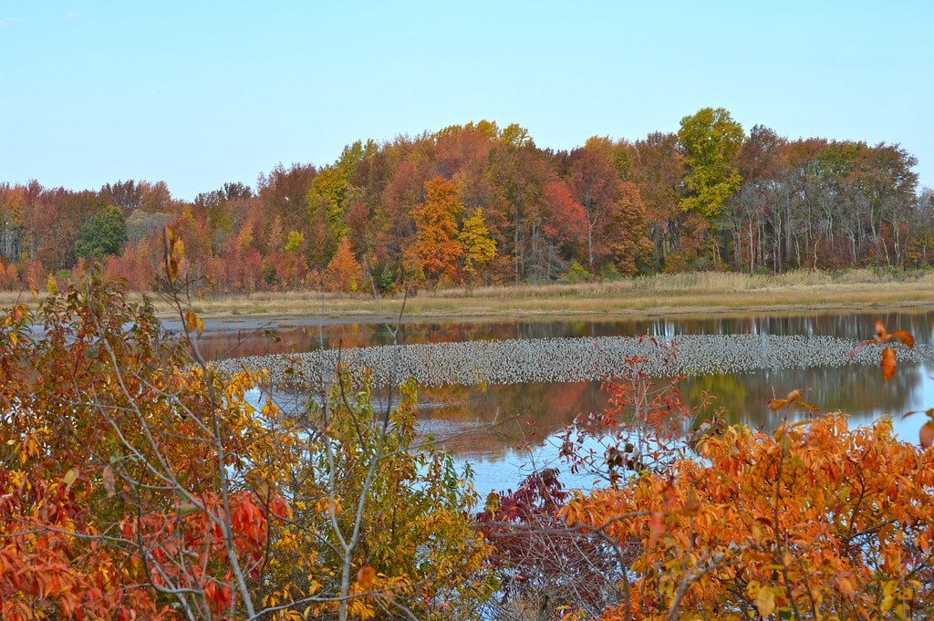
Birdwatchers talk about timing. Refuge managers think about it in weeks, inches, and surface area.
Every drawdown, every refill, is scheduled to match flight patterns.
The result looks natural, but the timing is mapped in advance and adjusted by hand.
As of 2009, Bombay Hook had logged 302 bird species in eBird.
Some are rare, blown in by the weather.
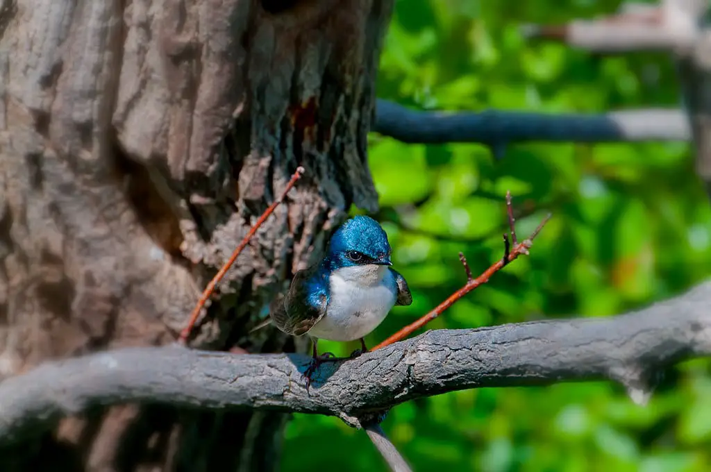
Most come on their usual routes, shorebirds in spring, ducks and geese in fall, and eagles across the cold months.
It's one of the most recorded migration stops in the mid-Atlantic.
In 1986, that pattern became a televised event.
National Geographic, the BBC, and Turner Broadcasting broadcast from Bombay Hook as part of "World Safari." Snow geese filled the pools.
The broadcast didn't explain how water levels had been adjusted in the weeks prior, but the timing wasn't random.
Other species are tracked with less fanfare. Refuge records list 35 confirmed mammals.
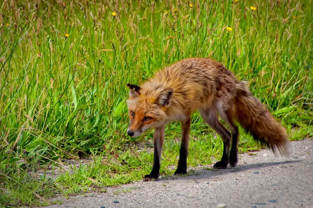
Otters and muskrats show up often. So do foxes and white-tailed deer.
Amphibians, reptiles, and turtles are documented as well, though some slip past the counts.
In 1990, a new clock was added to the system: the horseshoe crab spawn.
Volunteers tracked egg densities on Delaware Bay beaches.
Ten years later, harvesting limits were introduced.
Shorebirds depend on those eggs to complete their trip north.
Now, refuge staff time impoundment changes to match that brief window in May and June, because one missed cycle in the bay can ripple across half a continent.
Public Access, Visitor Infrastructure, and Daily Use
The layout doesn't advertise itself. The 12-mile wildlife drive loops quietly through the marsh, open from before sunrise to just after sunset.
Visitors set their own pace. They pull off when something catches their eye, an egret standing too still, a fox darting across a dike.
The road is gravel, narrow, and asks for attention.
Five walking trails branch off from that loop. The longest run is just under a mile.
Bear Swamp Trail and the path behind the visitor center are both accessible by wheelchair.
Others hug waterlines, snake through stands of trees, or cut straight across levees built decades ago.
Saltmarsh Boardwalk doesn't go far, but its wooden planks sit low enough to catch the smell of brine and mud.
Observation towers, three of them, offer elevation, not spectacle.
From the top of Shearness Tower, the marsh doesn't open up so much as flatten out.
The visitor center sits near the entrance. It keeps a schedule: open daily, 9 to 4.
Inside, the air is still. Walls hold migration charts, recent bird counts, and water level graphs.
No gift shop. No touchscreen exhibits. Seasonal programs get posted quietly.
School groups come through during the fall and spring, but walk-ins are left to sort things out for themselves.
Hunting is allowed during Delaware's designated seasons.
Waterfowl and deer only, with permits. Areas are marked on printed maps. Outside those boundaries, the marsh stays quiet.
Historical Structures and Forgotten Edge Zones
The Allee House stands north of the main drive, close to the edge of cultivated fields.
Built in 1753 by Abraham Allee, a Huguenot immigrant, it's one of the few pre-Revolution buildings still upright in Kent County.
Its brickwork, Flemish bond with glazed headers, remains intact.
The interior has not held up as well. Moisture crept through the walls over the decades.
The floor supports sagged. The chimney cracked. Public tours stopped years ago, and nothing suggests they're coming back.
Further east, where the marsh meets the bay, the remains get less attention.
The Bombay Hook Lighthouse once marked the entrance to the Smyrna River.
It was built in 1829, automated in 1912, and abandoned soon after.
It sat untouched for sixty years. Fire gutted the tower, and the state tore it down in 1974.
The road that once led to it was laid out in 1830, and it is barely visible now.
At the southern boundary of the refuge, Port Mahon had its own story.
Named after the capital of Menorca, it grew around a modest port, a blacksmith shop, a general store, and a dirt road to Little Creek.
A lighthouse went up in 1903. Its lamps burned kerosene, hauled out by cart when the marsh road allowed it.
The building burned in 1984. Only the pilings are left, sticking out of the tidal flat like fence posts without a fence.
None of these sites is preserved. No markers point them out.
But each one names a function the marsh once held: navigation, commerce, field patrol, before the land was put under federal title.
🍀

