
Clifton is easy to misunderstand if you start with a citywide rating.
Its own planning documents describe multiple neighborhoods, and those areas create practical differences: which side of a major road you live on, whether a station is reached by a comfortable walk, and whether ordinary errands sit on a neighborhood commercial street or require a drive.
For a property search, "Which Clifton?" is the useful question.
The city's December 2025 Open Space and Recreation Plan draft places Botany in the northeast, Allwood on the Bloomfield border, Athenia and Delawanna along the eastern side, and Clifton Center, Middle Village, Greglawn, and Richfield in the interior around the Garden State Parkway.
A few miles can change the repeated trips that shape a normal week. Compare the daily pattern each address creates. Keep the neighborhoods unranked.
Start with the route you will repeat five days a week
Clifton's April 2026 Master Plan Reexamination draft names Main Avenue, Allwood Road, Lakeview Avenue, Route 46/Piaget Avenue, and Lexington Avenue as commercial corridors.
It also treats transit, pedestrian safety, rail-station access, and the local street system as connected planning issues.
A neighborhood name is therefore only the first filter. The second is the route from a specific front door to the places you use most.
| Area | Daily geography to test | What can change within a few blocks |
|---|---|---|
| Allwood | Allwood Road, Route 3 and Garden State Parkway access; bus use versus driving | Walking conditions near Allwood Road, turns onto busy roads, and through traffic |
| Delawanna | Rail access and the route toward Delawanna station; Route 3 connections | Whether "near the station" means a continuous, comfortable walk |
| Athenia | Rail-station access identified in city planning and east-side street connections | The exact walking path, crossings, and whether errands sit on the commute route |
| Lakeview | Lakeview Avenue as a commercial corridor; Route 46 trips | Whether errands stay local or repeatedly pull you onto larger roads |
| Botany / East Clifton | Northeast-edge location and access to surrounding commercial streets | Which direction real errands pull you and which boundary streets you must cross |
| Clifton Center / Middle Village / Richfield | Interior location around the Garden State Parkway and access to Main Avenue | Whether frequent trips stay on your side of the Parkway |
The same address test applies to Dutch Hill, Rosemawr, Montclair Heights, Maple Valley, Albion, Hazel, and the city's other mapped sections.
Their value as neighborhood labels comes from the routes attached to them.
Two homes with the same Clifton mailing address can therefore produce different schedules.
One may let you combine a commute stop, takeout, and a pharmacy on one route. Another may send each task in a different direction.
"Near transit" is not the same as easy transit
Transit is where address-level detail becomes obvious.
The city's planning documents give Delawanna and Athenia special attention in rail-station and park-and-ride planning.
Delawanna also provides a concrete example of why the station itself is only half the question.
Clifton's 2024 Community Health Assessment includes a 2023 built-environment survey of Delawanna Avenue from Main Avenue to the train station.
That route scored 25 out of 30. The assessment noted sidewalks on both sides, but also uneven or narrow sections and faded crosswalks.
The same appendix assessed Allwood Road from the Bloomfield Avenue circle through the Promenade Shops and gave that route 13 out of 30, citing missing crosswalks and poorer sidewalk conditions.
Another 07012 route reaching Allwood Road scored 25, while noting a missing sidewalk on one side of part of Clifton Avenue.
Those are route observations, not neighborhood grades. That distinction matters.
"Allwood is walkable" or "Delawanna is walkable" is too broad when two nearby paths can work differently.
For a property search, measure transit in door-to-platform or door-to-stop reality. Walk the route when you would actually use it.
Look for continuous sidewalks, major crossings, lighting, the place where you wait, and what happens in bad weather.
There is also a newer option between walking and driving.
Passaic County MOVE, an on-demand shared transit service covering Clifton and Passaic, was renewed through 2027.
County materials describe it as a way to connect local trips and traditional transit. It can help with first- and last-mile access.
A difficult walking route remains a separate problem, so assess walkability on its own.
Commercial streets decide how much of life stays local
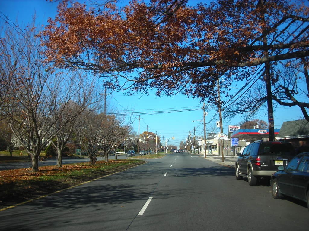
Clifton's commercial activity is distributed across several corridors.
Main Avenue has the city's strongest central-business-district role in the planning draft, while Allwood Road, Lakeview Avenue, Route 46/Piaget Avenue, and Lexington Avenue carry other retail and service concentrations.
That changes ordinary life more than a restaurant list does.
In Allwood, ask whether the stores and services you use sit naturally along Allwood Road or whether reaching them means repeated turns across busy traffic.
In Lakeview, test how much of your weekly routine can stay on or near Lakeview Avenue before Route 46 becomes the default.
In Clifton Center and nearby interior sections, Main Avenue may be geographically close.
The Parkway can still make route direction and crossing points part of the daily calculation.
Botany and East Clifton need the same treatment. Do not assume that a denser street pattern makes every errand walkable.
Take your real weekly list and test it from the address: groceries, coffee, pharmacy, gym, takeout.
If those trips all point toward different corridors, the home may function as more car-dependent than its surroundings first suggest.
For dining and leisure, the easiest outbound route can matter as much as the municipal boundary because Clifton borders several other North Jersey communities.
Noise and traffic belong to the block, not the neighborhood label
Check traffic and noise at the specific property, especially near Route 3, Route 46, the Garden State Parkway, rail infrastructure, and commercial corridors.
A home can sit inside a residential pocket and still be on the path drivers use to reach a ramp or commercial street.
Another address a few blocks away may have less through traffic.
Apartment orientation matters too: a bedroom facing a busy road can experience the same location differently from a rear-facing unit.
Do not rely on one midday showing. Conditions can change by hour, and a quiet weekend visit does not answer the weekday commute question.
Before signing a lease or making an offer, run one address test:
- Visit during the morning commute, around the evening commute, and after dark.
- Drive the first mile of your normal work route instead of checking only an estimated trip time.
- Walk the exact transit route you expect to use, including the largest crossing.
- Make one ordinary errand trip and note whether it stays inside the neighborhood.
- Spend ten minutes outside the property, then repeat the noise check indoors with the windows closed and open.
This test captures repeated friction that a neighborhood score misses.
Choose the address before you choose the story about Clifton
Start with the commute you will repeat.
Add the commercial corridor you will use for ordinary errands, the highway or Parkway access you actually need, and the walking route you are willing to make in bad weather.
Only then should the broader neighborhood reputation enter the picture.
That prevents a common mistake: paying for a feature that exists nearby but does not work in daily life.
A station can be close but awkward to walk to. A shopping corridor can be close but inconvenient to enter.
A highway can be close enough to save time and close enough to add traffic to the block.
In Clifton, a few miles can change the type of life more than a citywide ranking.
Choose the neighborhood and the repeated route first. Then decide whether that version of Clifton fits.

Sources and useful further reading
- City of Clifton - official website
- City of Clifton - Open Space and Recreation Plan, December 2025 draft
- City of Clifton - April 2026 Master Plan Reexamination draft
- City of Clifton - 2024 Community Health Assessment
- Passaic County - Passaic County MOVE one-year update and 2027 extension
Independent Publisher Notice
BestAttractions is an independent editorial publisher. We are not affiliated with, endorsed by, or acting on behalf of any location, business, property owner, manager, government agency, or organization described in this article.
Comments posted on this page are not forwarded to, reviewed by, or acted upon by any entity mentioned in the article.
For official inquiries, complaints, applications, bookings, or other requests, please contact the relevant entity directly through its official website or other verified channels.