Land That Sells Itself - The Terrain Portfolio of Cuyahoga Valley
The river bends like it's reconsidering its path. Southwest, then a sharp turn north - this "V"-shaped detour by the Cuyahoga doesn't follow convention, and neither does the ground beneath it.
What looks like ordinary Midwestern woods hides a stacked archive of geologic trades, cut and quarried across time.
The Berea Sandstone and Bedford Shale aren't just scenic - they're layered proof of an ancient river delta.
These rocks shaped what would later become quarry sites in Berea, South Euclid, and Cleveland Heights.
Grindstones, bluestone, building blocks - economic foundations carved straight from the earth.
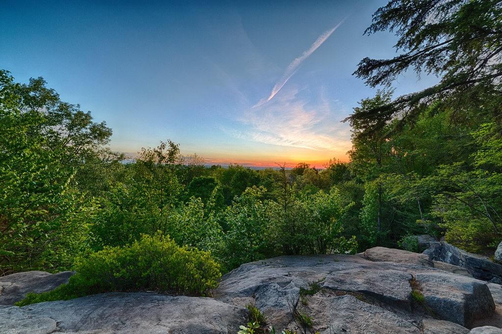
Higher up, the Sharon Conglomerate clings to the top of Boston Ledges.
It doesn't erode easily, so the ledges loom sharp and disjointed, their cracks widened by frost, the way concrete breaks under decades of freeze-thaw.
Beneath them, talus caves cluster like forgotten rooms in a ruined house.
Glacial debris - some 400 feet deep in places - sits in the valley like leftover inventory.
The soil still contains traces of Lake Maumee, Lake Arkona, Lake Warren, and Lake Wayne.
Then there's the Defiance Moraine: a wide ridge stretching east from Defiance, Ohio, through the Cuyahoga Valley like a frozen wave.
Its crest rises to 50 feet above the surrounding land, tapering south toward the Peninsula.
It marked the last major stand of ice before retreat.
And here, where the soil once helped sell grindstones and gas leases, people now walk the Towpath Trail looking for something quieter.
Still, the ground tells its story - quiet but exact, with every outcrop and gorge revealing part of a long-term deal between water, stone, and time.
For anyone looking for things to do in Akron, OH, the geology here isn't just background - it's the product.
As of 2025, the valley continues to have both economic memory and natural draw. It's still selling - just in a different way.
Leaseholders and Trade Routes - The Valley's First Tenants
Long before roads and rail lines cut through northeast Ohio, the Portage Path connected two major watersheds.
Eight miles of dry ground in what is now Akron allowed people to move their canoes from the Cuyahoga River to the Tuscarawas.
Everything else - from the Great Lakes to the Gulf - was water. That path wasn't just a shortcut; it was the hinge of a trade system.
By around 200 AD, the Hopewell Culture had already left its mark. They built the Everett Mound near what's now the park's southern end.
Later, the Lenapé moved through the same corridor, trading baskets, pottery, and stone tools.
They were part of a system that reached far beyond Ohio - stretching toward the eastern seaboard, pulling goods and stories in both directions.
The land was leased in more ways than one. The 1795 Treaty of Greenville set the Cuyahoga River as a line: settlers east, Native nations west.
Then came the 1805 Treaty of Fort Industry. Over 500,000 acres were ceded - including this valley - with a promise of annual payouts of one thousand dollars per nation.
The payments were uneven, and the hunting rights written in were mostly ignored.
Agriculture and the fur trade overlapped awkwardly. After European contact, the Lenapé shifted their hunting to meet demand.
Beaver pelts sold well, but the animals disappeared fast. Trade routes flourished, even as the land was being cleared.
The Lenapé called themselves the Lenape'wàk. They moved west under pressure - by treaty, by force, by policy - to Oklahoma, Ontario, and Kansas.
Still, pieces of their lives remain, mapped out in names and paths - Portage County, Tuscarawas River, and the trails that follow both.
Zoning the River - Fire, Freight, and Early Recreation
By the 1870s, people from Akron and Cleveland were already coming out here for the air.
The canal boats still ran. Carriage rides, picnics, a break from the coal smoke. When the Valley Railway opened in 1880, it gave factory workers a direct line to green space.
That was the early sales pitch - get out, breathe different air, go home.
In 1929, a bigger piece was added. Hayward Kendall, a Cleveland businessman, left 430 acres around the Ritchie Ledges to the state of Ohio.
He also added a trust fund, but with a rule: the land had to be used as a park.
The state named it after his mother - Virginia Kendall Park.
The 1930s brought federal dollars. The Civilian Conservation Corps, part of Franklin D. Roosevelt's New Deal, built infrastructure: Happy Days Lodge, Kendall Lake, shelters at Octagon, and the Ledges.
Those projects kept going through 1939.
By the 1950s and '60s, the story shifted. The Cuyahoga River had burned - first in 1952, then again in 1969. Those weren't the only fires, but they caught national attention.
The cause was easy to trace. Industry waste - paint, oil, chemicals - had turned the river into a hazard.
That same water once floated canal boats.
Local activists and officials started calling for federal protection. They worried about sprawl, runoff, and the speed of development along I-271 and Route 8.
The Environmental Protection Agency was new, as was the idea of saving post-industrial land by designating it a park.
In 1974, President Gerald Ford signed the bill creating the Cuyahoga Valley National Recreation Area.
His administration opposed it, saying the land didn't meet national park standards.
But the deal went through anyway - proof that zoning and preservation sometimes follow separate maps.
Federal Buy-In and the Cleanup Market
It started with real estate. After the 1974 designation, the National Park Service began acquiring land - houses, farms, patches of forest - one deal at a time.
There wasn't a master plan. Superintendent William C. Birdsell decided what to buy and what to leave.
Some homes were bulldozed, and others had scenic easements. Residents didn't always know which outcome they'd get, and that uncertainty wore thin.
In 1985, the park bought a 47-acre lot known as the Krejci Dump. It didn't take long to find out what was buried there.
After testing by the Environmental Protection Agency, the site was declared toxic - so toxic it qualified as a Superfund site under the 1980 CERCLA law.
Litigation followed. Ford, General Motors, Chevron, 3M, Chrysler, Waste Management, Kewanee Industries, and Federal Metals were all named.
Everyone but 3M settled. They took it to trial and lost. By 1987, crews had started removing contaminated soil - hundreds of thousands of tons.
The process dragged into 2012, and full restoration wrapped up in 2015.
While that cleanup was underway, another change took shape. On October 11, 2000, Congress passed House Bill 4578.
That bill didn't just adjust the budget - it reclassified the area. Cuyahoga Valley National Recreation Area officially became Cuyahoga Valley National Park.
The timing aligned with the demolition of the Richfield Coliseum in 1999. That arena, once a sports and concert venue, was cleared.
The land became part of the park. Now, it's a grassland, and birdwatchers consider it a top spot.
In 2024, the park entered a new agreement - this time across the Atlantic. Dartmoor National Park in Devon, England, signed on as a sister park.
The partnership is focused on conservation exchange - shared data, shared goals, and different landscapes.
Visitor Traffic and Experience Sales
By 2023, the visitor count hit 2,860,000, making Cuyahoga Valley National Park the twelfth most visited national park in the country.
One reason is its location, which stretches between Cleveland and Akron.
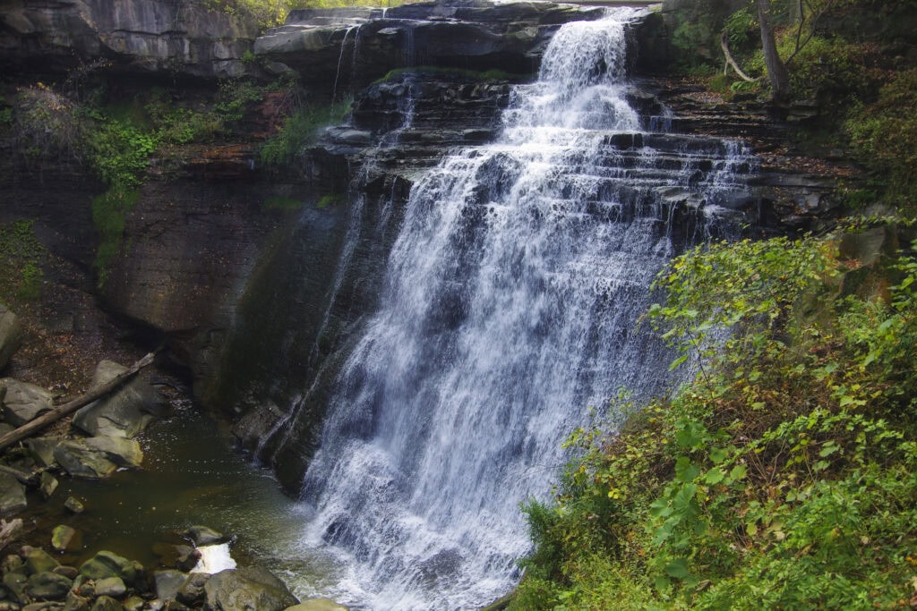
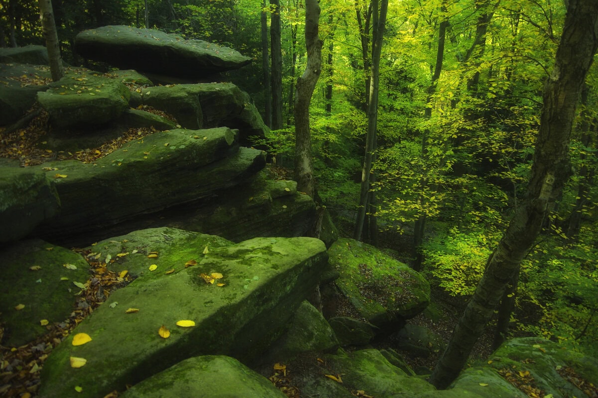
Some come for the 65-foot Brandywine Falls, the tallest in the park. Others walk through the mossy stone paths at the Ledges, where frost has cracked sandstone into uneven corridors.
Winter brings sledding to Kendall Hills. Fall colors draw railfans to the Cuyahoga Valley Scenic Railroad.
The train follows the canal route and offers a bike-and-ride service: riders can ride the trail one way and take the train back.
The park also mixes federal land with county properties, including parcels from Cleveland Metroparks and Summit Metro Parks.
That blend makes it unusual. It's not sealed off from businesses, homes, or roads. Nearby towns like Peninsula and Brecksville have shops and events that serve hikers and cyclists.
Preservation manifests in different ways. The Hale Farm and Village recreates 19th-century agriculture.
Blossom Music Center, which is run by Live Nation, hosts summer concerts. Kent State University's Porthouse Theatre adds seasonal performances.
The National Folk Festival was established here in the mid-1980s. The park still supports outdoor arts.
The Ohio and Erie Canal Towpath Trail, which stretches 20 miles through the park, remains a main draw.
Some sections connect to longer routes through Stark and Tuscarawas counties, which were built by local and state agencies.
Three visitor centers - Boston Store, Canal Exploration Center, and Hunt House - offer maps and information.
All are close to trailheads, making them part of the park's service network. This isn't remote wilderness. It's active land with layered uses.
Wildlife Inventory and Living Commodities
The animals here don't just fill the woods - they navigate a patchwork of easements, trails, and restored habitats.
Raccoons, foxes, muskrats, coyotes, beavers, and even bald eagles - the usual suspects across Ohio - cross into the park's acreage, weaving between protected land and private property.
The National Park Service tracks these species using data from trail cameras, volunteer reports, and drone surveys when needed.
Beavers have left their mark near the Towpath Trail. Their dams shift water levels, reshape access, and sometimes force reroutes.
Some of the same waterways once used to float canal boats now carry the marks of their engineering.
Otters returned after a long absence - spotted again along creeks like Brandywine and Furnace Run.
The old Richfield Coliseum site, absorbed into the park by 2000, has since turned into a meadow.
It now attracts grassland species, including hawks, kestrels, and migrating songbirds.
Audubon Society members log visits during spring migration, and birdwatching guides mention this site specifically.
Bats are also tracked. Seven species live in the valley. Researchers monitor roosting sites, mostly in old barns and hollow trees.
White-nose syndrome reached Ohio years ago, and monitoring efforts increased after 2012.
The mix of metroparks, farmland, commercial buffer zones, and public easements makes animal movement fluid but fragile.
Deers often feed near trail edges, minks follow creek lines, and river otters slip between backyards and riverbanks.
These crossings create both opportunities and risks, especially when adjacent land use shifts.
The National Park Service and partner groups run seasonal counts. These numbers feed into broader conservation databases, helping guide future park plans.
While most people look for views and waterfalls, the wildlife numbers are tracked, logged, and entered into files - updated every year and filed every season.


I've been to many National Parks across the country. Cuyahoga Valley National Park is one of the most beautiful and underrated parks. I'm fortunate to live a 10 minute drive away from the south entrance, so we visit regularly.
Cuyahoga is one of the few national parks near a major population center that still feels like an escape. In terms of daily usability, few parks match what Cuyahoga offers to nearby residents—especially ones like you who return often.