
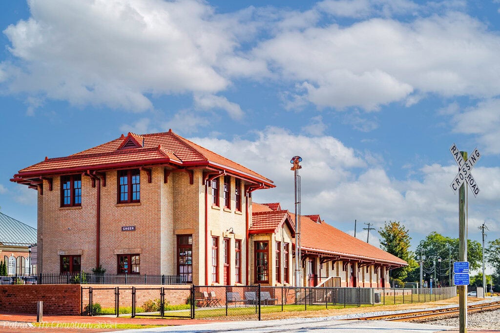
The old center wakes slowly. A few blocks of brick buildings sit along Trade Street and East Poinsett Street, close to a depot built for an earlier version of the local economy.
Outside that compact pocket, the day has already scattered: school traffic moves toward campuses on Hammett Bridge Road, East Gap Creek Road, and Gin House Road; production and warehouse shifts pull cars toward the wider Upstate; airport workers and travelers follow another clock entirely.
This is the central fact of living here. The city has a real center, but daily life rarely stays inside it.
The population reached an estimated 50,007 in July 2025, up 41% from the Census Bureau's April 2020 estimates base.
In 2010, only 25,515 people lived within the city. Growth at that speed does not merely add rooftops.
It changes school runs, grocery habits, commute calculations, and the amount of patience required at an intersection that still looks as though it belongs to a smaller place.
The Day Starts In Several Directions
A weekday here is less about distance than sequence.
One adult may leave early for a production, logistics, healthcare, or office job.
Another handles school drop-off before joining traffic toward Greenville, the airport area, or a workplace on the Spartanburg side.
The children may attend a campus carrying the same city name but belonging to an entirely different county system from a school only a few miles away.
By late afternoon, the pattern reverses through pickup lines, practices, pharmacy stops, and dinner.
The Census Bureau puts the mean commute at 24.3 minutes.
That average is useful only as a starting point.
A house that lines up cleanly with work and school can make the city feel compact.
A house that requires crossing several busy corridors at the wrong hour can turn a modest commute into the organizing problem of the day.
The school geography makes this unusually concrete.
Federal directories list local-address schools under both Greenville County and Spartanburg County: Riverside High and Middle sit on Hammett Bridge Road in Greenville County, another high-and-middle-school pair sits on East Gap Creek Road in Greenville County, while Abner Creek Middle on Gin House Road is in Spartanburg County.
A postal address therefore does not settle school assignment, county services, or every jurisdictional question.
For a household with children, the sensible order is parcel first, boundaries second, house tour third.
Reversing that order is how a pleasant kitchen becomes attached to a daily route nobody wanted.
By Late Afternoon, The City Folds Back In
The historic core matters because it gives scattered routines somewhere to meet.
The National Park Service lists both the depot and the downtown historic district, whose boundaries run roughly along Trade Street, East Poinsett Street, North Main Street, and nearby blocks.
The district is not large enough to carry the whole city, but it is legible: you can understand where the center is without being told by a monument sign.
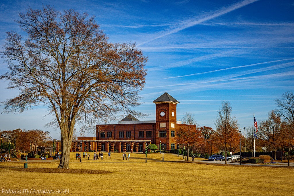
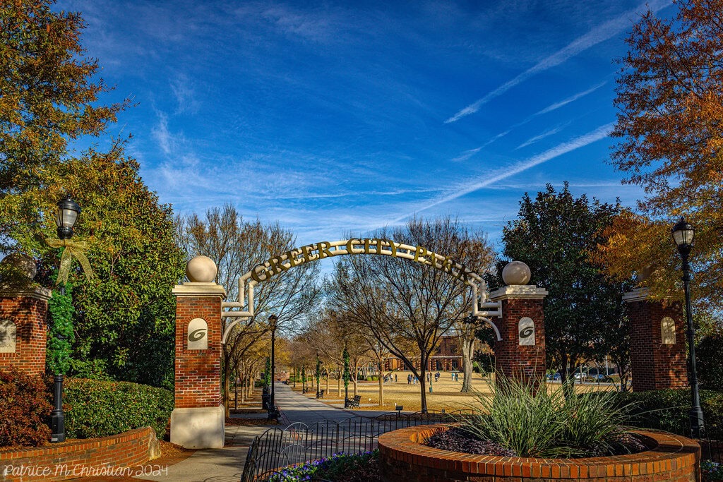
Just east of that core, the central city park provides the sort of ordinary civic space that fast-growing suburbs often forget to build until much later.
The South Carolina Department of Parks, Recreation and Tourism describes a 12-acre park with paved paths, a pond, a playground, picnic space, and an amphitheater.
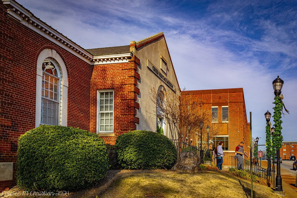
The South Carolina State Library also lists the Jean M. Smith Branch at 505 Pennsylvania Avenue as part of the Greenville County system.
Together, the park, library, and old commercial streets give residents a practical central loop rather than a visitor-only downtown.
That loop changes the feel of an ordinary evening.
A family can finish a library stop, let a child use the playground, and continue toward dinner without turning the outing into a metropolitan expedition.
An adult can walk the park while waiting for a practice or appointment to end.
The center is not where everyone spends every evening.
It is where a day with several unrelated errands can briefly make sense.
The House Is Part Of The Schedule
Housing still explains much of the appeal, but the old bargain-town story has expired.
As of June 30, 2026, the Zillow Home Value Index placed the typical home value at $354,804, up 1.9% over the previous year.
The Zillow Observed Rent Index stood at $1,702, up 2.6%, and homes were going pending in a median of 21 days.
Those figures describe a market with some room to think, not a market where affordability can be assumed.
The longer Census view shows why ownership remains central to local life.
During 2020-2024, 72.7% of occupied homes were owner-occupied.
The period's median owner-occupied value was $288,700, median monthly costs for owners with a mortgage were $1,553, and median gross rent was $1,198.
Those are historical-period measures rather than current asking prices, but they describe a city built around households expecting space, vehicles, storage, and years rather than months.
The catch arrives in the driveway.
A less expensive house can require another car, more fuel, and a longer chain of school and work trips.
Here, housing cost and transportation cost are often the same bill printed on different paper.
Work Comes With A Shift Change
The wider economy is not an office-park monoculture.
In the BLS metropolitan area covering Anderson, Greenville, Laurens, and Pickens counties, production jobs made up 9.4% of employment in May 2025, compared with 5.5% nationally.
The average hourly wage across all occupations was $28.49, while production occupations averaged $23.48.
These figures describe Anderson, Greenville, Laurens, and Pickens counties; they do not include Spartanburg County, so they capture an important part of the local labor market rather than every workplace used by residents.
That scope limit matters because the Census Bureau's 2020 geography catalog places parts of the city in both Greenville and Spartanburg counties, while households often use a broader Upstate job map.
The practical takeaway is not a single wage number.
It is that work schedules here can begin before the traditional office morning, end after school pickup, or move through production, maintenance, healthcare, transportation, and material-moving roles as readily as through professional offices.
The airport adds another layer.
The Federal Aviation Administration's location listing pairs Greenville-Spartanburg International Airport with this city.
That does not make the whole place airport-adjacent, but it gives many residents a regional convenience that is genuinely part of ordinary life: flights, airport jobs, visiting relatives, and business travel do not begin with a long drive to another metropolitan area.
Saturday Is The Honest Test
A good local-living article should survive Saturday.
The most revealing weekend is not a festival weekend.
It is the one with no plan.
Someone needs a library book returned, someone else wants to be outside before the afternoon heat, and the household still has groceries, sports, repairs, or a birthday errand waiting farther out.
The central district can absorb the first half of that day.
The park's paths, playground, pond, and open space give families and walkers an easy destination.
Trade and East Poinsett streets supply the older storefront scale that distinguishes the center from the wider commercial landscape.
The library gives the trip a reason even when nobody intends to browse shops or stay for a meal.
Then the city expands again.
Larger errands usually return people to the car.
Teenagers without a driver have fewer independent options once they leave the central pocket.
Older residents who no longer drive may live close to services in miles and still far from them in practice.
The downtown proves that walkable local life exists here; the rest of the weekend proves how geographically limited it remains.
Summer Moves Everything Earlier
The climate does not merely describe the city.
It edits the timetable.
NOAA's 1991-2020 normals for the local station put July's average daily high at 90.3 degrees and the average daily low at 69.2.
The same record shows an average of 17.5 July days reaching at least 90 degrees.
That pushes park walks, yard work, youth sports, and errands toward morning.
By midafternoon, shade and air conditioning decide how long people linger.
Evening becomes useful again, especially in the central park and downtown pocket, but summer rarely allows residents to ignore heat while planning the day.
The benefit is a long outdoor season and relatively mild winters.
The cost appears in cooling bills, stormwater, drainage, and the fatigue of moving between hot parking lots.
Buyers who inspect a house only from the front should also look at where water goes after a hard rain and how much afternoon sun reaches the windows.
The Address Keeps Answering Back
After six months, the city's small frictions become easier to name.
The first is boundary confusion.
The city name can sit on an address that belongs to a different county, school system, or service arrangement from another address nearby.
The second is road dependence.
A household can enjoy the center and still need two cars to make work, school, healthcare, and activities fit together.
The third is growth itself.
A population increase of 41% in five years means construction, changing routes, and public systems adjusting while people are already using them.
Healthcare is more grounded than in many outer suburbs: the Centers for Medicare & Medicaid Services lists a hospital provider within the city.
Specialist care and insurance networks still extend across the larger region, but every hospital visit does not begin with a drive into a distant downtown.
Safety requires the same address-level discipline as schools.
A single citywide grade would be false precision; no current neighborhood-level official series used here supports one.
Visit the exact block at the hours you will use it.
Check lighting, traffic speed, sightlines, drainage, nearby commercial activity, and which agency has jurisdiction.
A generic score cannot tell you whether the daily walk from a parking space to a front door feels reasonable.
The City Is More International Than Its Old Story
The inherited image is a Southern railroad and mill town.
The current population is more complicated.
Hispanic or Latino residents make up 16.1% of the population, 12.6% of residents are foreign-born, and 18.1% of people age five or older speak a language other than English at home.
More than a quarter of residents are under 18.
These figures help explain why schools, groceries, churches, youth activities, and neighborhood routines feel less culturally uniform than the old-town architecture might suggest.
The diversity is not staged for visitors.
It shows up in who is waiting at pickup, who works the second shift, which languages children carry home, and how quickly a new subdivision stops feeling new because several kinds of households arrived at once.
That can be one of the city's quiet strengths.
New residents do not have to fit into a sealed historical identity.
The place is still deciding what its next version will be.
Who Will Be Comfortable Here
This city works best for people who want regional access without making a large nearby downtown the center of every day.
It suits households tied to manufacturing, engineering, logistics, healthcare, aviation, and the wider Upstate employment network.
It suits families willing to verify school boundaries before choosing a house.
It suits people who value a yard, garage, or extra bedroom more than being able to walk to every errand.
It also suits residents who want a genuine historic center for evenings and weekends, provided they accept that most of the city still runs by car.
It will frustrate people expecting cheap housing simply because the state is South Carolina.
It will frustrate anyone trying to build a fully car-free life outside the central pocket.
It may also wear on residents who dislike construction, fast population growth, hot summers, or the administrative messiness of a city split across county systems.
The people most likely to stay are not necessarily those who came for a bargain.
They are the ones whose work, school, airport use, housing needs, and weekend habits line up well enough that the city saves them time.
The City At Last
The city is Greer, South Carolina. Its daily life runs on two clocks.
One belongs to Trade Street, East Poinsett Street, the old depot, the park, and the library - places where the city becomes compact and recognizable.
The other belongs to school roads, shift changes, subdivisions, county lines, and an airport that connects the Upstate to somewhere else.
Neither clock is decorative. Residents use both.
That is why Greer can feel warmer and more grounded than a generic growth suburb while remaining more complicated than the phrase "small-town charm" suggests.
The old center gives the place memory. The spreading city gives it work, housing, schools, and momentum.
A good life here depends on whether those pieces fall in the right order for your household.
References
Housing data source: Zillow Home Value Index and Zillow Observed Rent Index, June 2026. Data Provided by Zillow Group.
Zillow, Greer, SC Housing Market, Zillow Home Value Index and Zillow Observed Rent Index through June 30, 2026. Data Provided by Zillow Group.
U.S. Census Bureau, QuickFacts: Greer city, South Carolina, July 1, 2025 population estimate and 2020-2024 demographic, housing, commuting, and income measures.
U.S. Bureau of Labor Statistics, Occupational Employment and Wages in Greenville-Anderson-Greer, SC - May 2025, published July 8, 2026; metropolitan scope limited to Anderson, Greenville, Laurens, and Pickens counties.
U.S. Census Bureau, 2020 Census PUMA Reference Map Catalog for South Carolina, city geography shown in both Greenville and Spartanburg counties.
National Center for Education Statistics, Search for schools near ZIP code 29650, Greenville County school directory results.
National Center for Education Statistics, Search for schools near ZIP code 29651, Greenville and Spartanburg county school directory results.
National Park Service, South Carolina National Register of Historic Places listings, listing years for the Greer Depot and Greer Downtown Historic District.
National Park Service, 1997 National Register weekly listings, Greer Downtown Historic District boundaries and September 18, 1997 listing.
South Carolina Department of Parks, Recreation and Tourism, Enjoy Plenty of Playtime in Greer, city park size and recreation features.
South Carolina State Library, Greer Branch, branch name, county system, and address.
Federal Aviation Administration, ATCSCC Flight Delay Information, Greenville-Spartanburg International Airport location listing.
National Centers for Environmental Information, Summary of Monthly Normals 1991-2020 for station USW00003870, July temperature normals generated June 22, 2026.
Centers for Medicare & Medicaid Services, Prisma Health Greer Memorial Hospital, hospital provider record.
Independent Publisher Notice
BestAttractions is an independent editorial publisher. We are not affiliated with, endorsed by, or acting on behalf of any location, business, property owner, manager, government agency, or organization described in this article. Comments posted on this page are not forwarded to, reviewed by, or acted upon by any entity mentioned in the article. For official inquiries, complaints, applications, bookings, or other requests, please contact the relevant entity directly through its official website or other verified channels.