Think you know Palmdale, California? Most people are unaware of the origin of its name or that a military training mission once set parts of the city ablaze.
Some streets have fractions in their names. A lake near the freeway shrinks and reappears depending on the season. And behind fences near Plant 42, aircraft have been tested that never officially existed.
Some nights, residents still spot zigzagging lights overhead, caught on doorbell cameras and never explained.
These are the kinds of details even long-time residents miss. Here's what's strange, forgotten, or quietly hiding in plain sight.
The city was named for palm trees that never existed
In 1886, a group of German and Swiss Lutheran settlers arrived in the Antelope Valley looking for farmland.
They believed the region's Joshua trees were palm trees and named their new settlement Palmenthal - "palm valley" in German.
The mistake stuck. The name changed to Palmdale when the community moved closer to a new Southern Pacific Railroad stop in the 1890s.
There were never any actual palm trees in the area when the name was chosen.
Today, Joshua trees are still scattered across the desert landscape, especially east of Sierra Highway, and the original Palmenthal location is marked by a historical sign on Fort Tejon Road near Barrel Springs Road.
An Air Force missile drill accidentally set fire to the suburbs
In August 1956, a Navy drone flying over the California desert went out of control.
Air Force jets were sent from Oxnard to shoot it down, and they fired 208 rockets over Palmdale and its surrounding hills. The drone kept flying.
Some of the rockets hit houses, cars, and open fields, starting more than 20 small fires and damaging buildings and power lines.
No one was killed, but at least three people were injured. The Air Force called it a training error.
It became known as the "Battle of Palmdale" and remains one of the most damaging friendly-fire events in U.S. peacetime aviation history.
A Grid With Letters and Fractions
Palmdale's street grid uses an alphanumeric system that confuses many newcomers.
East-west roads are named using letters, starting with Avenue A at the north end and moving down alphabetically.
Between each lettered avenue, smaller roads are labeled with fractions, like Avenue R-8 or Avenue Q-12.
North-south roads are numbered from 1st Street to 270th Street and marked as East or West, depending on which side of Division Street they fall.
The result is a precise but non-intuitive system that can lead to addresses like "36060 47th Street East at Avenue P-12." This structure reflects the city's rapid mid-century expansion.
A Government Airfield Behind the Fence
Air Force Plant 42 covers over 5,000 acres east of Sierra Highway in Palmdale.
It is a government-owned, contractor-operated airfield that supports aerospace manufacturing, modification, and testing.
Major aerospace companies, including Boeing, Lockheed Martin, and Northrop Grumman, maintain large hangars and production facilities on-site.
The complex is managed in connection with Edwards Air Force Base and has security-controlled entrances.
NASA's Rockwell International facility assembled several Space Shuttle orbiters during the program's operational years.
Enterprise, Discovery, and Atlantis each underwent final assembly here before being flown on the Shuttle Carrier Aircraft to Kennedy Space Center.
Most stealth aircraft in U.S. history were built here
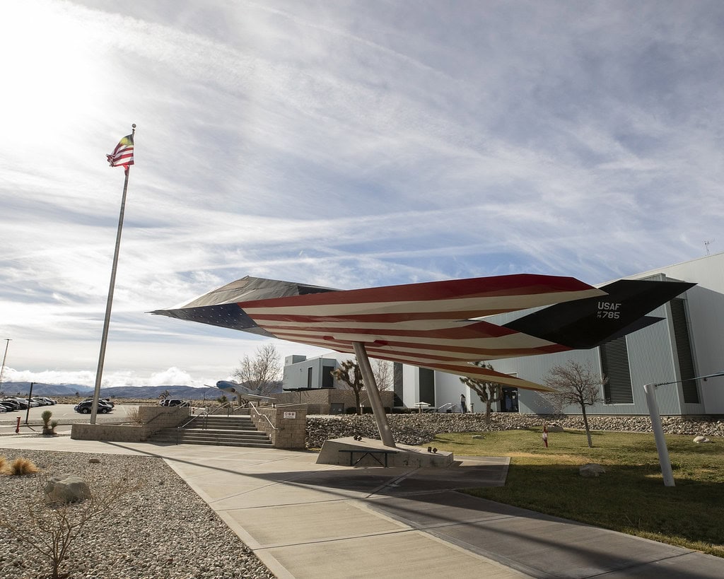
Air Force Plant 42, located on the northern edge of Palmdale, has served as a production site for many of the country's most secretive military aircraft.
The SR-71 Blackbird, B-2 Spirit bomber, F-117 Nighthawk, and modern F-22 and F-35 fighters were all assembled or tested at the facility.
Northrop Grumman, Lockheed Martin, and Boeing have operated from Plant 42 since the Cold War.
Although much of the work is classified, aerial photos show large hangars and runways surrounded by desert.
The site's location in the Antelope Valley provides isolation and airspace needed for testing experimental aircraft.
UFO reports are common, and some are on camera
On multiple nights in August 2024, residents in Palmdale and Lancaster reported fast-moving lights in the sky.
Some of the sightings were caught on doorbell cameras and shared on social media.
The lights moved in irregular patterns: zigzags, sudden stops, and sharp turns.
Law enforcement agencies referred questions to federal aviation authorities, and no public explanation was given.
Local historians say similar reports have surfaced for decades, often coinciding with new aircraft testing or military exercises in the area.
A music video desert stands in for anywhere
Several music videos and commercials have used Palmdale's desert roads and hills as generic backdrops.
In 2013, Britney Spears filmed the video for her single "Perfume" along the Sierra Highway.
The video features a desert motel and stretches of empty road, typical of eastern Palmdale.
Avril Lavigne also shot parts of her "Rock N Roll" video in the area.
The region's dry landscape and open skies make it a frequent stand-in for the American Southwest in film and television.
A Flying Observatory Kept Here
NASA's Armstrong Flight Research Center operates the Aircraft Operations Facility in Palmdale inside Building 703, a converted Air Force hangar.
It housed SOFIA, the Stratospheric Observatory for Infrared Astronomy, a heavily modified Boeing 747SP with a large infrared telescope mounted in its fuselage.
From this location, the aircraft received maintenance. They prepared for science flights that operated at altitudes above most of Earth's atmosphere.
NASA images and mission reports confirm SOFIA's base in Palmdale and document its activities from the facility until the observatory's retirement in 2022.
A short-lived city in the 1800s vanished from the map
Before Palmdale was officially incorporated, a small settlement named Harold tried to establish itself just east of what is now 47th Street East.
Founded in the late 1800s as a stop on the Southern Pacific Railroad, Harold had a post office, a general store, and a few homesteads.
But it never grew beyond a few dozen residents. By the 1920s, Harold had been absorbed into Palmdale's expanding grid and disappeared from maps.
Today, the area is a residential neighborhood near Barrel Springs Road.
No original buildings remain, and the name Harold is remembered only in historical surveys and local documents.
One of the longest average commutes in the U.S.
According to 2024 data from the U.S. Census and traffic studies, Palmdale has the longest average commute time of any city in the country, more than 90 minutes per day round-trip.
Many residents work in Los Angeles or the San Fernando Valley but live in Palmdale for its lower housing costs.
Commuters typically use the 14 Freeway or the Metrolink Antelope Valley Line, both of which are heavily used and prone to delays.
Planners have proposed high-speed rail and bus rapid transit, but those projects remain in early stages.
Palmdale's commute time has steadily increased since the early 2000s.
The Schoolhouse That Traveled
Palmdale's first schoolhouse was built in 1888 at Avenue R-8 and 27th Street East for children in the original Palmenthal settlement.
It was a small, wooden structure serving a rural farming community.
As the settlement moved closer to the railroad, the building was eventually relocated to William J. McAdam Park.
Today, the restored schoolhouse sits in the park near sports fields and parking, open to the public during events.
A high desert lake that disappears
Lake Palmdale, a man-made reservoir on the southern edge of the city, stores water from the California Aqueduct.
It feeds into the Littlerock Reservoir and helps supply water for the Palmdale Water District.
The lake sits in a desert basin and can dramatically shrink during dry years.
In 2015, it dropped so low that parts of the lakebed were exposed for weeks.
Although it is off-limits to the general public, the lake can be seen from Sierra Highway and the nearby Pelona Vista Park.
It is one of the few bodies of water in the Antelope Valley that changes size with rainfall and aqueduct use.
A Fault Line Beside the Traffic
State Route 14 passes through a roadcut in Palmdale just north of Avenue S. The exposed rock layers here mark the trace of the San Andreas Fault.
Caltech's Southern California Seismic Network lists the location as one of the most visible fault exposures in Los Angeles County.
The roadcut was created during freeway construction, cutting directly into the fault zone.
Drivers can see the geologic contact while traveling northbound or southbound, without leaving their vehicles. The site is used in geology field trips.

