
Two facts explain most of how Lakewood works day to day. The first is that there is no center.
Residents use several, for different reasons: Fort Steilacoom Park for anything outdoors, South Tacoma Way for the International District, Lakewood Towne Center and Colonial Center for errands, Tillicum and Woodbrook for a neighborhood life that barely overlaps with the rest of the city.
Even the official Downtown Subarea covers more than 300 acres, which is not a downtown anyone walks across.
The second is I-5. The freeway cuts through the city and shows up in decision after decision - in where a subarea boundary stops, in how Tillicum and Woodbrook are planned together across I-5, in why one park east of the freeway carries an entire neighborhood.
On a map, Lakewood looks connected. In practice, the question is usually which side you're on.
Downtown is 300 acres, and Motor Avenue is the closest thing to a civic street
The city officially counts Lakewood Towne Center, Colonial Center, and the East Commercial District as Downtown.
Together they cover more than 300 acres - part of why "downtown Lakewood" never behaves like a compact old main street where everything sits within a short walk.
Motor Avenue is the closest thing the city has built to a civic street.
Lakewood rebuilt Colonial Plaza there in 2019 with a wide brick-paved roadway, seating, landscaping, and room for public events, and added a steel gateway in 2023 carrying phrases and memories collected from residents.
The plaza now draws street festivals and city events, including a May street festival in 2026.
A few miles away, the Lakewood Station District has its own plan built around the Sounder station, St. Clare Hospital, Pacific Highway, Bridgeport Way, and the SR-512 park-and-ride.
Even there the freeway sets the edge.
When the city explained the Station District boundary, it put I-5 at the southeast cutoff and cited the freeway itself as the barrier - a planning document saying out loud what residents already navigate around.
Fort Steilacoom Park absorbs most of the city's public life
Fort Steilacoom Park is 340 acres and takes more than a million visits a year, and its size is the point: several unrelated crowds can use it simultaneously without meeting.
There is a 22-acre fenced off-leash dog area, a paved loop of roughly a mile around Waughop Lake, a marked 5K route, sports fields, an orienteering course, picnic shelters, a playground, and an area set aside for radio-controlled aircraft and drones.
In summer, Tuesday is the day.
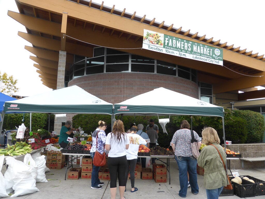
The 2026 farmers market ran from 2 to 7 p.m. from June into early September, and the Summer Nights concerts used the same Tuesday evenings at the Pavilion.
Market, food-truck dinner, a lap around Waughop, and a concert can all happen without crossing town twice.
The same park carries the city's largest annual gathering and several other recurring events: SummerFEST in August 2026, Fiesta de la Familia in September, Truck & Tractor Day in the fall.
Spring puts it to a different use - Parks Appreciation Day sends volunteers into Fort Steilacoom and other parks to pull weeds, haul trash, and clean up before the heavy season starts.
One landmark there means nothing unless you used the old Lakewood library.
The enormous Tenzler Log cross-section that stood outside that branch for decades was moved to Fort Steilacoom in 2024 before the old library was demolished.
It now sits near Waughop Lake, familiar and completely out of context.
Wards Lake is the park long-time residents have to relearn
Wards Lake Park was rebuilt in 2025 and reopened to the public that December. The city held the formal grand opening in April 2026.
The rebuild changed a 38-plus-acre site from several directions. More than a mile of trail was added or improved, with a paved multi-use route crossing Wards Lake by bridge.
At the north end, the work brought a concrete pump track, an expanded play area, the picnic shelter, and a Portland Loo. The south end now gives riders a 3.5-acre trail system and skills area, alongside a second playground and the dog park.
Access changed with the park. The 84th Street entrance gained more parking, 88th Street gained accessible spaces for the dog park, and 25th Avenue South gained a neighborhood entrance and parking area.
The work also reached the lake itself. Crews restored 700 feet of shoreline and removed invasive plants across more than 10 acres, and a bird blind was added for wildlife viewing.
Anyone who knew Wards Lake as the quiet local alternative to Fort Steilacoom now has a different park, and a different reason to go - a short bike session, a dog-park stop, a birding loop, rather than a festival or a field sport.
Thirteen public street ends, and the city says they aren't parks
Lakewood's current lake-access inventory counts 13 sites where public street property reaches the water.
Seven are on Lake Steilacoom, two on American Lake, two on Lake Louise, two on Gravelly Lake.
The city's terminology gets strange here: its street-end page says the sites aren't parks or parkland, then includes Edgewater Park among the 13.
A street end can be entirely public and still have no restroom, no dock, no formal parking, no developed path.
Several barely read as public access at all.
Residents are also not allowed to improve them on their own initiative.
At the 100th Street access on Lake Steilacoom, unauthorized vegetation clearing brought in the Washington Department of Ecology and left the city responsible for corrective shoreline work.
The city's guidance since then is straightforward: leave it, unless it's permitted.
One street end is moving through the formal upgrade process - Westlake Avenue. On roughly 0.2 acre, the pilot design adds parking, seating, shoreline work, and an accessible paved route to the water.
Lake Steilacoom has the odder problem.
Edgewater Park remains largely undeveloped, and its boat ramp is the only public launch on Lake Steilacoom. The current layout has no designated pedestrian access or formal parking, and the city is trying to fix the traffic conflicts around the road and launch.
As of September 2026 the project was at 30 percent design, with permitting expected to run into 2027.
American Lake Park is the developed counterexample, though small - about 5 acres on the north shore.
The public boat launch charged $15 for a single launch in 2026, and payment at the launch is card-only; seasonal passes go through City Hall.
In Tillicum, the state-owned Camp Murray launch is still little more than gravel and a basic ramp.
Lakewood and the Washington Military Department are working on a master plan to improve public water access there, but there is no construction funding yet, and the plan has to account for Camp Murray's security and operational needs.
Where I-5 separates Tillicum and Woodbrook, the city plans them together
Woodbrook entered the city's neighborhood planning in 2024. The new Tillicum-Woodbrook Subarea Plan superseded the 2011 Tillicum plan and covered land on both sides of I-5.
That was not a tidying-up of lines on a map.
The plan calls for better connections, more community and civic space, and transportation improvements in a subarea where I-5 separates Tillicum from Woodbrook and the city is still looking for local connections that don't depend on the freeway.
Residents on either side can be neighbors by distance and strangers by route.
Tillicum runs on places that barely register in central Lakewood. Harry Todd Park is the neighborhood's developed American Lake waterfront.
The Tillicum Community Center is where the Tillicum-Woodbrook Neighborhood Association meets on the second Tuesday of every month.
Camp Murray is immediately next door, and JBLM starts just past it.
East of the freeway, the arithmetic is starker.
City planning documents describe Springbrook Park as Lakewood's only park east of I-5, so one site does the work of several. The dog park, basketball court, pump track, community garden, paths, and picnic space all sit around Clover Creek, where the completed project restored about 400 feet of shoreline.
When the city brought its 2026 neighborhood outreach to Springbrook, it held it in the park - the obvious venue, because there isn't another.
South Tacoma Way is an International District in more than name
The corridor is another of Lakewood's centers that never routes through Towne Center.
The city's 2025-2026 budget puts the share of minority-owned businesses along it at more than 88 percent.
Korean businesses have anchored the corridor for years, joined over time by other Asian, Latino, and immigrant-owned businesses.
The city treats it as its own thing rather than an annex of downtown, handling it separately in road and streetscape projects.
Several planning and economic-development pages are published in English, Korean, Tagalog, and Spanish, and multilingual signage along South Tacoma Way long predates the city's own translations.
JBLM sets the sound calendar and part of the land-use code
An unusually loud afternoon does not necessarily come with an alert attached.
The public notices cover the bigger exercises and nighttime artillery or mortar work likely to be heard beyond JBLM.
Daytime routine is different. Artillery, aircraft, helicopters, or demolition can be part of an ordinary Wednesday with no JBLM public notice.
Prescribed burns follow their own rule: JBLM posts those on social media during the summer.
The military presence also shapes what can be built.
North of McChord Field, Lakewood's AC1 and AC2 zones limit how intensely land can be developed along the aircraft approach corridor.
C-17 traffic overhead is not only background noise for the neighborhoods underneath it - it is written into the land-use rules on the ground.
Civic life happens in churches, schools, and parks
The Neighborhood Connections program shows how dispersed the city really is.
In 2026 the "Desserts on the Driveway" meetings were held at the Tillicum Community Center, United Methodist Church at Lakewood, Oakbrook Elementary, Lakewood Playhouse, Springbrook Park, and the Pavilion at Fort Steilacoom Park, with a former school site in Lake City scheduled for September.
Those venues are not interchangeable - each neighborhood has the place it actually gathers, and the city brings officials to it rather than expecting everyone to come to City Hall.
The library has been through its own strange interval.
Pierce County Library System closed the old Lakewood branch in June 2022 because the building was unsafe.
Some of the old Wildaire branch came back with the service. Books, furniture, interior signs, and artwork were reused when the 7,500-square-foot interim library opened at 10202 Gravelly Lake Drive SW in September 2024; it operates seven days a week with full library service.
It has since grown a full set of habits - study rooms, children's programs, book sales, and Lakewood Readers. Holiday and closure conflicts sometimes push that book club one week later; otherwise it meets on third Mondays.
The word "interim" is doing a lot of work for a building people have organized their weeks around.
The Senior Activity Center is split between rooms and outdoors.
Several programs run out of City Hall, while "Just a Walk in the Park" meets near the Fort Steilacoom dog park on Monday mornings.
The walk happens in rain and is called off only for snow, ice, or high winds - a city program whose meeting room is half City Hall and half trailhead.
The distance between what exists and what's finished
Local knowledge in Lakewood is mostly a sense of where each public place sits between those two things. At one end are Wards Lake and Colonial Plaza: rebuilt, unambiguous, done.
At the other is a stretch of legally public shoreline that looks like the gap between two fences. Almost everything else is somewhere in the middle, and the name on the map is a poor guide to which.
The library shows how far the middle can stretch. "Interim" described a stopgap when the branch opened in September 2024, two years after the old building was closed as unsafe; it now describes a place with study rooms and a third-Monday reading group.
Edgewater runs the other direction - the official public access to Lake Steilacoom, sitting at 30 percent design with permitting pushed into 2027.
The launch beside Camp Murray has a master plan in progress and no construction money. The Tillicum-Woodbrook plan calls for better connections through a subarea I-5 will continue to divide.
So the useful questions here are rarely the ones a map answers. Not where the lake access is, but whether you can park at it.
Not whether the neighborhood has a park, but whether it has the only one on its side of I-5. Not what the building is called, but how long it has been called that.
Sources and further reading
- City of Lakewood - Lakefront Street Ends
- City of Lakewood - Parks Capital Projects
- City of Lakewood - Fort Steilacoom Park
- City of Lakewood - Subarea Plans
- City of Lakewood - Neighborhood Connections
- Joint Base Lewis-McChord - Noise and Disturbances
- Pierce County Library System - Lakewood Library
Independent Publisher Notice
BestAttractions is an independent editorial publisher. We are not affiliated with, endorsed by, or acting on behalf of any location, business, property owner, manager, government agency, or organization described in this article. Comments posted on this page are not forwarded to, reviewed by, or acted upon by any entity mentioned in the article. For official inquiries, complaints, applications, bookings, or other requests, please contact the relevant entity directly through its official website or other verified channels.