
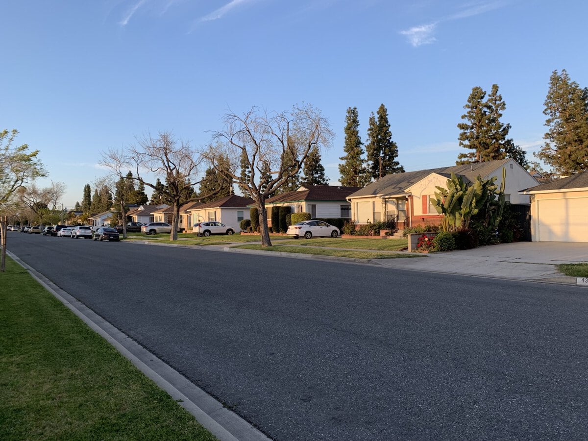
In 1950, the houses arrived almost as an extension of the assembly line.
The nearby Douglas Aircraft plant had swollen during the war, and the flat land inland from Long Beach became a vast answer to a practical question: where would all those workers and their families live?
Low ranch houses spread across newly drawn streets with garages, small yards, and enough room for a washing machine, a television, and the postwar promise that ordinary people could own something solid.
Seventy-six years later, the same modest house can represent an $884,735 decision.
That reversal explains daily life here. The city still feels built for households rather than spectacle.
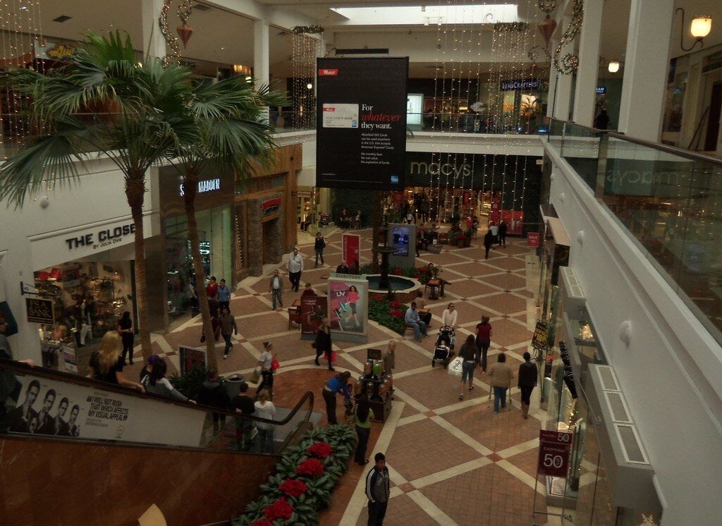
School drop-offs, grocery runs, appointments, and a trip to the regional mall fit neatly into the week.
Yet entering that routine now belongs to a different economic era than the houses themselves.
The starter house became an $884,735 decision
The Zillow Home Value Index placed the typical local home value at about $884,735 in June 2026.
Nearby Long Beach stood around $862,989, while California overall was near $775,549.
These are typical values, not sale prices.
This inland suburb no longer offers a major discount to the larger coastal city beside it.
The older Census measure, covering 2020 through 2024, put the median value of owner-occupied homes at $827,200.
It also recorded median monthly owner costs of $2,951 for households with a mortgage.
A plain three-bedroom ranch can carry an extraordinary payment without looking remotely extravagant.
Renting is not an escape hatch.
Median gross rent was $2,347, above both the California figure of $2,036 and the Long Beach figure of $1,871.
Apartments exist, but the place remains ownership-heavy: 71.4 percent of occupied homes are owner-occupied, compared with 41.2 percent in Long Beach.
A renter can live here. The center of gravity still belongs to homeowners.
Six figures does not feel extravagant here
Median household income reached $119,177, and only 5.8 percent of residents lived below the federal poverty line.
Those are strong numbers. They also sit inside one of the country's costliest metropolitan regions.
The Los Angeles area consumer price index rose 3.3 percent over the year ending June 2026.
Food prices increased 2.4 percent, shelter 2.8 percent, and energy 15.1 percent.
A family may look comfortable on a national spreadsheet, then watch the mortgage, child care, insurance, electricity, and two cars divide the money.
No single cost-of-living number captures every household.
Housing takes a large bite, regional inflation remains visible, and the city's practical advantages do not arrive cheaply.
The economy is mostly something you drive through
This is not a downtown employment center disguised as a suburb.
It is a residential city surrounded by a much larger labor market.
Retail sales reached roughly $1.57 billion in 2022, a striking amount for 9.4 square miles, while health care and social assistance generated about $451 million in receipts.
Local commerce matters, but so do jobs beyond the boundary.
The regional unemployment rate for Los Angeles, Long Beach, and Anaheim was 4.8 percent in May 2026.
Locally, 67.7 percent of residents age 16 and older participated in the labor force.
The average commute took 28.4 minutes, which sounds manageable until the direction, hour, and freeway are added.
Remote work improves the equation. Broadband subscriptions reached 94.5 percent of households.
For someone whose office is a spare bedroom, the city offers the domestic infrastructure of suburban life without requiring a daily journey into Los Angeles.
For everyone else, the road network remains part of the job description.
Four district names hide inside one house hunt
A buyer can cross one major street and enter a different school system.
Addresses in this compact city may fall within ABC Unified, Bellflower Unified, Long Beach Unified, or Paramount Unified.
That makes the casual phrase "the local schools" unusually misleading.
The correct question is narrower: which elementary, middle, and high school serve this exact parcel?
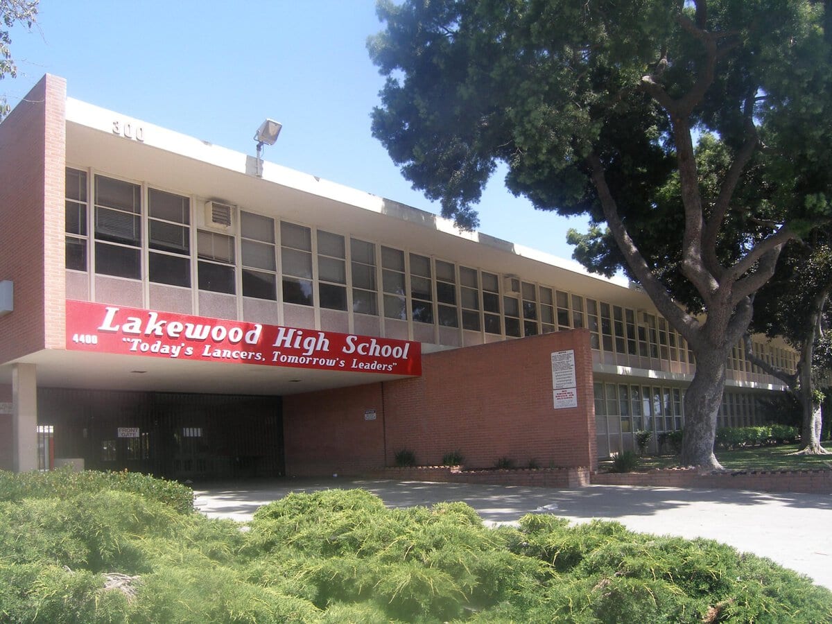
One visible example is Mayfair High, where the 2025 California School Dashboard reported a 94.2 percent graduation rate and a Green performance level for that indicator.
It is useful evidence about one campus, not permission to generalize across four districts.
School boundaries deserve to be checked before the kitchen cabinets become persuasive.
Transfer rules, specialized programs, and campus results can change the value of two otherwise similar houses.
In this market, that homework belongs near the beginning of the search, not after an offer is accepted.
A real hospital changes the practical map
The state health-facility database lists a general acute-care hospital here with 172 licensed beds and a basic emergency department.
That is a meaningful piece of daily infrastructure, especially for families with children, older relatives, or chronic conditions.
The Census Bureau estimated that 5.5 percent of residents under age 65 lacked health insurance.
Insurance coverage does not guarantee an easy appointment, and a hospital listing does not answer every specialist question.
Still, having an operating emergency department inside a city this small changes the geography of an urgent night.
For routine care, residents also draw on the larger medical network across Long Beach and southeast Los Angeles County.
The advantage is proximity to several layers of care, not medical self-sufficiency.
Safety resists a neat score
A responsible citywide crime rate is harder to produce than many neighborhood websites suggest.
The permitted federal and state systems organize much local reporting by law-enforcement agency.
In this case, neither the FBI Crime Data Explorer nor California's OpenJustice interface offers a clean standalone city series that can be reproduced without risking a mix of jurisdictions or reporting definitions.
That is not evidence that the city is unusually safe.
It is evidence that a tidy commercial grade may imply more precision than the official data support.
A serious move therefore requires a smaller lens.
Visit the block after dark. Look at lighting, alley access, parking patterns, and how exposed cars are overnight.
Ask about package theft and vehicle break-ins without turning one anecdote into a citywide verdict.
Safety is lived at the address level long before it becomes a colored score on a map.
Mild weather, hard ground
At nearby Long Beach Airport, mid-July normals are around 81 degrees for the high and 65 for the low.
Summer rain is scarce, winters are mild, and outdoor routines rarely face the long seasonal shutdown familiar in colder states.
The ground is the less gentle part of the bargain.
The magnitude 6.4 Long Beach earthquake struck on March 10, 1933, damaging schools and unreinforced buildings across the region.
Modern construction standards changed because of disasters like that one, but the regional hazard did not disappear.
For a postwar house, preparation is ordinary and physical: secure tall furniture, brace the water heater, know the gas shutoff, and examine the foundation and retrofitting history.
Flood risk should also be checked by exact address through FEMA's current map service rather than inferred from a citywide label.
The bus helps; the car organizes the week
Long Beach Transit routes connect the regional mall corridor, South Street, Del Amo Boulevard, downtown Long Beach, and neighboring employment and shopping areas.
The network can make a known commute or regular errand workable without driving.
It does not turn the city into a rail suburb.
Most households still organize the week around keys, parking, and arterial roads.
The Census commute average of 28.4 minutes is plausible for a nearby destination and much less informative for a peak-hour trip toward central Los Angeles.
Long Beach Airport sits just to the southwest and gives residents a practical regional airport without first crossing the entire basin.
That convenience is real, and two working adults with school pickups and appointments will still tend to prefer two cars.
What daily life rewards
Compactness is the city's quiet advantage.
About 78,000 people live within 9.4 square miles, producing a density of roughly 8,774 residents per square mile.
Shopping, schools, medical care, and neighboring cities sit close together even when traffic makes them feel farther apart.
The community is also less uniform than the repeated ranch-house streets suggest.
Hispanic or Latino residents make up 38.9 percent of the population, Asian residents 17.8 percent, and Black residents 7.1 percent.
More than one in five residents were born outside the United States.
That mix shows up less as a grand cultural district than in ordinary commerce, school communities, family restaurants, and weekend routines.
The city rewards people who value convenience over theater.
The pleasures are cumulative: a short grocery run, a familiar field, a doctor nearby, an airport that does not require a cross-county expedition.
What begins to wear
The same structure that makes the city easy can make it feel narrow.
Housing is expensive, most trips favor a car, and the built-out street grid leaves limited room for dramatically different housing choices.
Anyone seeking a walkable historic center, apartment towers beside rail, or nightlife downstairs will spend a great deal of money to remain unsatisfied.
The population estimate fell to 78,010 in 2025, down 5.4 percent from the 2020 estimate base.
That does not make the city empty or unstable.
It does complicate the old image of a place defined by endless family growth.
The postwar machine built quickly; the modern city has little empty land left to repeat the trick.
This is also a place where buyers can mistake tidiness for simplicity.
Four school districts, regional commutes, earthquake preparation, and a near-$885,000 typical home value all deserve more scrutiny than the quiet streets initially suggest.
The name on the map
This is Lakewood, CA, the postwar city between Long Beach, Bellflower, Cerritos, and Hawaiian Gardens.
It fits households that can afford an expensive detached home, value routine and regional access, and prefer a settled residential block to an urban address.
Remote workers may find the equation especially persuasive.
Families can make it work well, but only after treating school boundaries as seriously as the house itself.
It is a poor fit for anyone seeking inexpensive California, reliable car-free living, dramatic architecture, or nightlife outside the front door.
The price buys competence, proximity, and a very specific kind of order.
The old assembly-line promise survives, but the monthly payment has moved far beyond 1950.
On the map: Open Lakewood, CA in Google Maps
References
Zillow Group, Housing Data, Zillow Home Value Index, June 2026. Data Provided by Zillow Group.
U.S. Census Bureau, QuickFacts: Lakewood city, Long Beach city, and California, population, housing, income, commuting, broadband, business and demographic data.
U.S. Bureau of Labor Statistics, Consumer Price Index, Los Angeles Area, June 2026, annual changes for all items, food, shelter and energy.
U.S. Bureau of Labor Statistics, Los Angeles Area Economic Summary, May 2026 regional labor-market data.
California Department of Education, California School Directory, school and district assignments serving the city.
California Department of Education, 2025 California School Dashboard Report for Mayfair High, graduation-rate indicator.
California Department of Health Care Access and Information, UCI Health-Lakewood Facility Profile, licensed beds, facility status and emergency-service classification.
Federal Bureau of Investigation, Crime Data Explorer, official agency-based crime reporting interface.
California Department of Justice, Crimes and Clearances, state crime-data definitions and reporting interface.
National Centers for Environmental Information, U.S. Climate Normals, 1991-2020 station normals.
U.S. Geological Survey, M6.4 March 10, 1933 Long Beach, California Earthquake, magnitude, date and regional impact.
Federal Emergency Management Agency, Flood Map Service Center, address-specific flood-map lookup.
Long Beach Transit, Routes and Services, current regional bus connections.
Long Beach Airport, Parking and Directions, official airport access information.
Library of Congress, Douglas Aircraft Company Long Beach Plant, Historic American Engineering Record on aircraft employment and postwar residential growth.
Independent Publisher Notice
BestAttractions is an independent editorial publisher. We are not affiliated with, endorsed by, or acting on behalf of any location, business, property owner, manager, government agency, or organization described in this article.
Comments posted on this page are not forwarded to, reviewed by, or acted upon by any entity mentioned in the article.
For official inquiries, complaints, applications, bookings, or other requests, please contact the relevant entity directly through its official website or other verified channels.